|

|
|
位於東海岸(Eastern
Seaboard)中央位置的馬裡蘭是聯邦(1788年)剛成立時的最初13州之一。據稱馬裡蘭此名是由1632年時,收到這片土地的特許狀的巴爾地摩(Lord
Baltimore)閣下所命,旨在紀念英王查理一世(King
Charles I)之妻瑪麗亞皇后(Queen
Henrietta Maria)。1760年代時,為解決賓州及卡爾維特(Calvert)家庭之間的紛爭所設下的梅遜狄克遜分界線(Mason
and Dixon line),除了是賓州及馬裡蘭之間的邊界外,也是傳統的南北分界線。
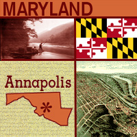
又名「自由之州」(Free
State)的馬裡蘭,其州花是黑眼蘇珊花,而首府是亞那波裡(Annapolis),即美國海軍官校(U.S.
Naval Academy)的所在地。
One of the original 13 states to join the Union (in 1788), Maryland is in the middle of the Eastern Seaboard. It's believed that Lord Baltimore, who received a charter for the land in 1632, named the state after Queen Henrietta Maria, wife of King Charles I. The Mason and Dixon line was drawn in the 1760s to settle a dispute between the Penn and Calvert families. In addition to marking the boundary between Pennsylvania and Maryland, it is the traditional boundary between the North and the South. Maryland is known as the "Free State"; its flower is the black-eyed susan; and its capital is Annapolis, home of the U.S. Naval Academy.
|
|


|