| |
|
 |
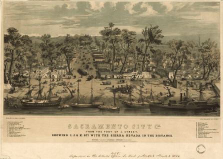
拓荒者在沙加緬度 (Sacramento) 的生活 |
|
|
一張沙加緬度 (Sacramento) 地圖, 1850 出處: Cooper, George Victor, and Charles R. Parsons, panoramic map artists. "Sacramento City, Ca. from the Foot of J. Street, Showing I., J., & K. Sts. with the Sierra Nevada in the Distance." New York, Stringer & Townsend, copyright 1850. Panoramic Maps, 1847-1929, American Memory collections, Library of Congress.
|
美國國會圖書館 | 法律聲明 | 隱私權聲明 | 網站地圖 | 與我們連絡 |