|

|
|
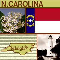
北卡羅來納的第一個歐洲殖民地是著名的洛亞諾克島(Roanoke
Island),它於1587年後的某個時刻消失無蹤。1629年時,英王查理一世(King
Charles I)封賜了一塊土地,而北卡羅來納則位於這塊土地的北方,為紀念英王查理一世,才以他的名字為這片北部土地命名(Carolus是查理的拉丁字)。北卡羅來納於1789年加入聯邦,成為美國原始的13州中的第12州。觀光業是它的主要工業之一,因為許多美國人會到此處享受當地漂亮的海灘。「焦油腳州」(Tar
Heel State)的首府是洛利(Raleigh),而它的州花是山茱萸。
The first European settlement in North Carolina is the famous Lost Colony of Roanoke Island that vanished sometime after 1587. North Carolina is the northern portion of the original 1629 land grant made by England's King Charles I, which was named in his honor (Carolus is Latin for Charles). North Carolina joined the Union in 1789 and is the 12th of the original 13 states. One of its major industries is tourism, as many Americans travel to the state to enjoy its beautiful beaches. The capital of the "Tar Heel State" is Raleigh, and the dogwood blossom is the state flower.
|
|


|