| |
|
 |
北達科達 (North Dakota) 與南達科達 (South Dakota) 於1889年11月2日加入聯邦了 |
|
|
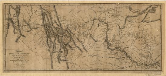
這是路易士和克拉克遠征隊的地圖,你知道達科達在哪裡嗎? 出處: Lewis, Samuel. "A map of Lewis and Clark's track, across the western portion of North America from the Mississippi to the Pacific Ocean: by order of the executive of the United States in 1804, 5 & 6 / copied by Samuel Lewis from the original drawing of Wm. Clark ; Saml. Harrison, fct.." 1814. Map Collections: 1544-1999, Library of Congress. |
美國國會圖書館 | 法律聲明 | 隱私權聲明 | 網站地圖 | 與我們連絡 |