|

|
|
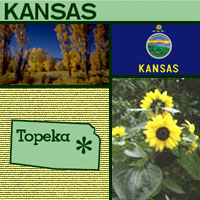
別名「向日葵之州」(Sunflower
State)的堪薩斯在1861年加入聯邦,成為美國第34州。堪薩斯一字源自於坎薩族或考族印地安人,它是一個蘇族印地安名詞,意即「南風區域內的人」(south
wind people)。堪薩斯的邊界是北美洲的磁性中心點。美國、加拿大及墨西哥在進行土地測量時,都會以此點為參考點。
美國境內,48個相連州的地理中心位於堪薩斯平原上。長於這片土地上的向日葵是堪薩斯州的州花,而它的首府是托皮卡(Topeka)。
Known as the "Sunflower State,"
Kansas became the 34th state in 1861. The state's name comes from the Kansa or Kaw Indians and is a Sioux Indian term meaning "south wind people." Within Kansas's borders is the magnetic center mark for all of North America. All land surveys in the U.S., Canada, and Mexico use this as a reference point. The geographic center of the 48 contiguous (connected) states is located in a
Kansas pasture. The native sunflower is the state flower and the capital is Topeka.
|
|


|