|
原本已經可以經由水路到達阿拉斯加,愛爾肯公路開通後,就可以從陸路到達阿拉斯加了

|
|
|
|
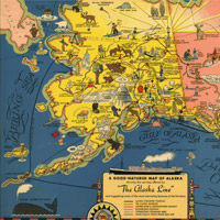
阿拉斯加州的愛爾肯公路 (Alcan
Highway) 開通了:1942年11月21日
你有沒有美國的哪一條公路印象特別深刻呢?你一定會記得愛爾肯公路。在零下35度的寒冷天氣中,連接阿拉斯加與加拿大的愛爾肯公路於1942年11月21日正式全面通車。這是一條相當重要的軍事補給路線,長達1522英里的公路連接加拿大卑詩省 (British
Columbia) 的道森溪 (Dawson
Creek) 與阿拉斯加的費爾班克斯 (Fairbanks) ,途中多是荒野地帶。因為面臨日本可能經由阿拉斯加入侵美國的威脅,使得建造這條公路成為第二次世界大戰期間政府的首要工作之一。藉由這條愛爾肯公路,軍方能夠運輸軍隊、食物,以及各種補給品到阿拉斯加的戰略要地。你覺得建造這條公路要花多少時間呢?
Have you traveled on any memorable highways in the U.S.? You would surely remember the Alcan Highway. Following chilly festivities held the day before with a temperature of 35 degrees below zero, the Alaska-Canadian (Alcan) Highway opened for its first full day of traffic on November 21, 1942. This important overland military supply route, a 1,522-mile roadway through the wilderness, connected Dawson Creek, British Columbia, with Fairbanks, Alaska. The threat of Japanese invasion through Alaska made the road a World War II priority. Over the Alcan Highway, the military could transport troops, food, and supplies to strategic points in Alaska. How long do you think it took to construct?
 1/3 頁
1/3 頁

|