| |
|
 |
從蹄鐵灣(Horseshoe Bend)到「淚水小徑」(Trail of Tears) From Horseshoe Bend to the Trail of TearsTears |
|
|
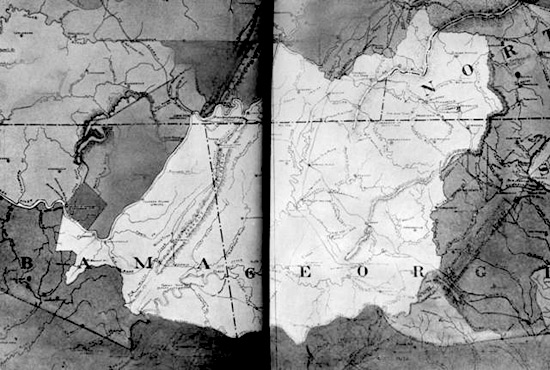
1835年東部卻洛奇族(Cherokee) 的地圖 A map of the Eastern Cherokee Nation in 1835 出處: "Map of Eastern Cherokee Nation (unshaded)." A map; the unshaded area is the boundary of the Eastern Cherokee Nation in 1835. Title and "1835" hand-written on back of print. Photoprint of a map. From History of the American West, 1860-1920: Photographs from the Collection of the Denver Public Library. Reproduction Information: Not from Library of Congress collections. From Special Collections The Denver Public Library. Reproduction Number: X-33759 |
美國國會圖書館 | 法律聲明 | 隱私權聲明 | 網站地圖 | 與我們連絡 |